Day 2 dawned. Legs hurt. Not to the level I had expected though.
Perhaps I am cut out for this?
No. The paltry 34km of the previous day does not a champion make.
The day’s destination? Chur.
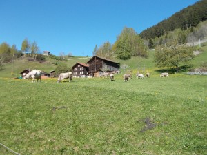
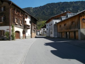
Opening the curtains, I found day already dawning on the Swiss countryside surrounding Disentis. Very easy to like that place. Sun. Wind. Barnyard aromas. Happy cows jingling their neck bells whilst feasting on the endless green grass. Just lovely.
Should have been a farmer? Probably.
Should have been a Swiss cow? Absolutely.
Following a relaxed (and delicious) breakfast, we loaded up the bikes and set out. Peddling away from the hotel, an elderly gentleman waved us down.
“Which way are you going?”
…
“Don’t go that way. It goes up and down, up and down. Take the highway.”
Noted.
The guidebook specifically suggested getting off the highway and onto the bike route. Decision time. Take the highway and have more cars salivating on our rear racks? No. Did that coming off the pass. Quiet bike trail? Yes, please!
Onto the bike route and further down into the Rhine valley we went. Easy at first. Paved.
Suddenly, gravel. Big gravel. What the? A passing route sign confirmed that we were in fact going the right way. I briefly pondered whether a mountain bike would have been a more appropriate bike for this trip.
Rounding a corner, the backside of a bulldozer came into view.
Oh.
The trail was under repair. Had to make the 20 minute climb back up to the highway. Legs warm. Older gentleman probably laughed his tail feathers off at us. Deserved.
First lesson of riding the Rhine: Listen to the locals. They know.
Even so, there are far worse places to find oneself having to take an unplanned detour. Cycling amidst the Swiss hills with the sound of cowbells all around is never a bad thing.
Rejoining the highway, we rode several kilometres amidst the mild traffic searching for an ideal place to rejoin the route. The highway runs high above the river, so it was very difficult to tell exactly what might be the best way back down.
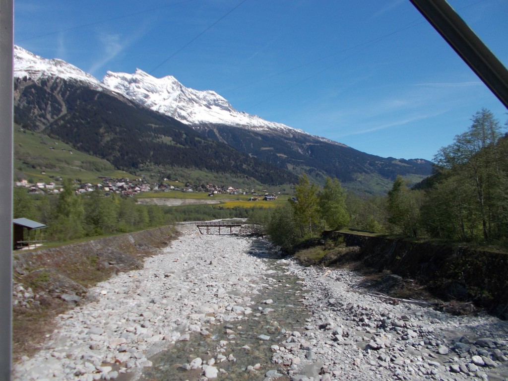
Assuming that we had passed the section of trail under construction, we chose a 4-wheel drive track leading into the valley from the highway down through the town of Cumpadials. As seemed to always be the case in Switzerland, we hadn’t ridden far before finding a sign indicating the direction to the local bike route, which in this case was route #2, the Rhine route. Crossing the river to rejoin the route, we stopped briefly to snap a few photos of the infant Rhine.
At this point the route generally flattened, and we rode for several easy kilometres through several farming villages, stopping in Reits to purchase some local cheese, and again in Rabius to have a snack.
Beyond Rabius, the route more or less followed the highway, sometimes climbing above it to take less travelled paths through the farm lands, other times dropping down near the river. Riding all of these sections was easy to navigate and enormously pleasant. Traffic was never an issue, and there was plenty to see. We made excellent time through this segment.
Outside of Tavanasa the route passed a large reservoir and crossed back to the south side of the Rhine. The next few kilometres were very peaceful as they wound alongside the Rhine alternating between fields and forest. After passing a live gun range a few kilometres west of Rueun, we stopped to eat again, looking out over the fields as we ate. Sausage, cheese, bread, and of course, chocolate. A cyclist’s lunch.
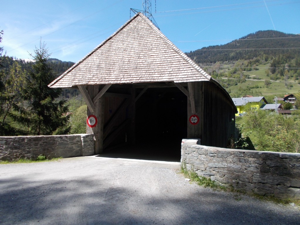
Coming up to Rueun we stopped to take pictures of the first covered bridge over the Rhine which joins the southern bank with the town of Rueun.
Passing Rueun, we rode several more kilometres to Ilanz, seemingly the largest town in some time. There’s a supermarket there, as well as a bike shop. Pressing on, the route begins to climb away from the river. We knew that the Ruinaulta gorge lay ahead and the climb would take us above its epic cliffs.
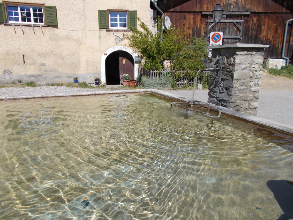
A short while after leaving Ilanz we stopped in the town of Castrisch to fill our water bottles. Most towns in Switerland have a public fountain, and unless otherwise indicated, they spout fresh mountain drinking water. For a cyclist, this was a dream because we had a constant easy supply of great water. There was never a need to ration our water supply on longer segments.
The weather was beautiful as we continued to climb. Sun was out. Air crisp and clean. Very healthful. I was loving every second.
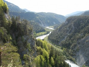
Coming away from Castrisch, the route climbs more steadily. My legs were really starting to earn their keep. Creeping into view as we climbed: The Ruinaulta gorge. A short downhill and a steeper climb and we rounded a corner through Carrera, beyond which the Ruinaulta came fully into view:
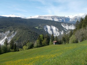
The Ruinaulta is sometimes called “Switzerland’s Grand Canyon”, and while it’s not nearly as vast or deep as the actual Grand Canyon, it’s every bit as nice to look at. The kilometres we rode atop the Ruinaulta were among the most scenic of the entire Rhine route, cementing Day 2 among my favourites of the entire tour.
After idling along the top of the gorge for about half an hour, another wild descent over a 10km stretch of great road. Awesome. Like Day 1, the descent was great fun as we thumped down the mountain with great haste.
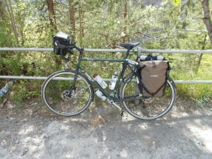
Following a series of downhill switchbacks, the route crosses a bridge and begins to climb again, rising once again atop the Ruinaulta. The climb was not arduous, and near the top we found a great place to pull over and snack between two tunnels. There were multiple lookout points here from which to survey the valley floor. It also served as an ideal to complete every cyclist’s favourite pastime: Photographing one’s bike.
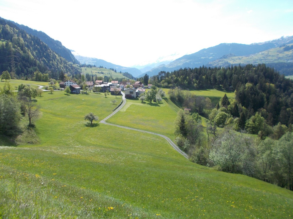
Leaving the turnout between the tunnels, we cycled a bit further and found a scenic outcropping developed as a tourist lookout for the Ruinaulta. We paused again to look back over the valley, snowy peaks still visible in the distance. Looking ahead, it was clear that the scenery was changing. We were coming out of the mountains and into the hills.
Beyond the Ruinaulta lookout, the route descends mildly into Bonaduz. True to the information in our guidebook, this was the first place where the route became momentarily hard to follow. There is a hard left turn that must be made at an intersection in Bonaduz, that despite being well signposted, is very easy to miss.
Finding our way, we descended some more, then the path began alternate between small climbs and descents. This section was filled with small farms selling their goods. We stocked up. More sausage. More cheese. More fruit veggies.
Beyond the farms we rode through a relatively flat section into the outskirts of Chur; a much larger city than any we had yet encountered. Entering the town, we again lost the route in the confusion of busier traffic. Eventually finding our way, the route passes into town passing the central train station where we dismounted and began searching for accommodation.
Chur is a nice city, but I didn’t find all the hustle and bustle to be a welcome change compared to the sleepy country villages we had been frequenting since we began the ride. Checking into a hotel in the old town center I felt myself missing the sound of cowbells. Didn’t matter though, I still slept like a log.
Day 2 Stats
Day’s distance: 79.18km
Seat time: 4:48
Max speed: 55.2 km/h
Ave. Speed: 16.4 km/h
Total distance: 113 km